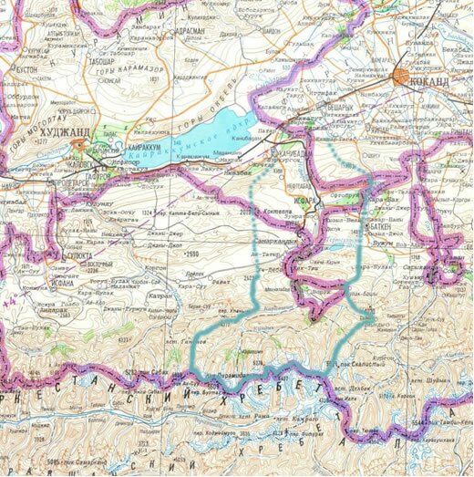
Isfara river
The Isfara river basin is located in northern Tajikistan and south-western Kyrgyzstan. The river originates on the northern slopes of the Turkestan Range at an altitude of 4,500-5,000 m and flows northwards through the Ferghana valley towards the Syrdarya river. The total length amounts to about 120 km. Due to complete use of its flow for irrigation purposes the Isfara river does not reach the Syrdarya.
The Isfara is a snow-glacier fed river. High waters start in the second half of April, and in some years in May and lasts to October. The average annual discharge adds up to 457,3 million m3 and the catchment covers an area of 1,560 km2.
The Isfara river basin belongs to Sugdh Oblast in Tajikistan and to Batken Oblast in Kyrgyzstan. About 185,000 people live in the basin. The population of Batken consist of mainly ethnic Kyrgyz, with a large Tajik and a smaller Uzbek minority. Several Tajik and Uzbek enclaves located inside the Kyrgyz Oblast’s territory which has led villages being bisected by the Tajikistan-Kyrgyzstan border and to Kyrgyz ethnic majorities in Tajik villages.
The project activities will be implemented near the town Isfara in Tajikistan and in the west of Batken Oblast. Currently, GIZ is implementing a project on Isfara and Khodzha-Bakirgan rivers including a ratification of an Interstate Framework Agreement on transboundary river basin cooperation between Kyrgyzstan and Tajikistan. This agreement can serve as a legal basis for activities of the proposed project, such as creation of a small basin council and development of an IWRM action plan.